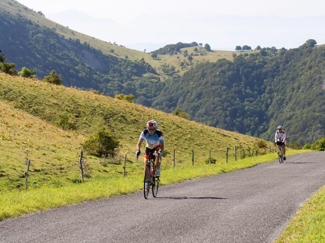
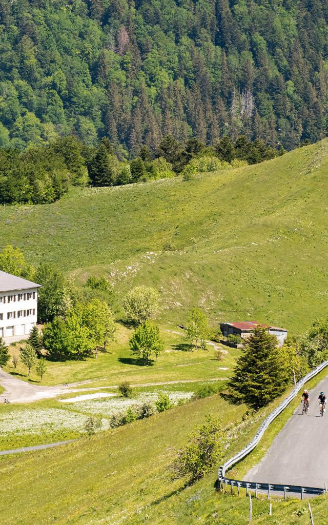
Cycliste dans les pentes du Grand Colombier lors d'une journée cycloCycliste dans les pentes du Grand Colombier lors d'une journée cyclo
©Cycliste dans les pentes du Grand Colombier lors d'une journée cyclo|Laurent Madelon

The nicest climbs in Bugey near the Grand Colombier

The legendary Grand Colombier climb and the many others in theareas are a fantastic playground for pure climbers and cyclists of all levels.

Find on this page the different difficulties of the most beautiful climbs in the area with our suggestions for associated loops!

Grand Colombier (1501 m)

Take on the Grand Colombier climb, star of the Tour de France 2012, 2016, 2017, 2020 and 2023!

More difficult than Alpes d’Huez and most alpine climbs, Grand Colombier is recognized to be one of the most difficult climb in France having four very difficult and different ascents. From the 22% gradient above Virieu le Petit to the 14% hairpins above Culoz, the 4 roads are all classified as hors-categorie climbs.

Climbing the Grand Colombier on a road closed to cars with food and refreshments offered at the top is possible 4 days a year during the cycling days of Grand Colombier on the second Saturdays of June, July, August and September!
In 2024, these carfree cycling days will be held on 8 June, 13 July, 10 August and 14 September.

Will you be part of the brotherhood of the “Fêlés” (loonies) by climbing in the same day two, three or four round-trip climbs of the Grand Colombier by different starting points?

From Culoz:
18,3 km. Elevation gain: 1262 m. Average gradient: 6.89%.
Undoubtedly the most beautiful and scenic of the 4 different roads. From the town of Culoz, the ascent of the Grand Colombier reveals a breathtaking landscape. You will be able to admire the Alps, the Belledonne massif, the Mont-Blanc and an overall view on Bugey, Lake Bourget, Lake Annecy and even Lake Geneva! The spectacular hairpins of Colombier are accessible a few kilometers above Culoz.
Beware, do not trust the average percentage of the whole climb, this road is irregular and promises important heat in the first 7 kilometers because of the cliffs. Then, halfway through the route, the forest parts allow you to rest a little before attacking the second part that is just as difficult as the first. One piece of advice: save some strength for the last kilometer’s percentages!

Col du Grand Colombier, Culoz, France

• Distance: 17.4 km, Elevation: 1250 m, Avg. Grade: 7.3 %

From Artemare, through Virieu-le-Petit:
15.9 km. Elevation gain : 1251 m. Average gradient: 7.87%.
The steepest one! The ascent of the Grand Colombier from Artemare (via Virieu-Le-Petit) is known to be one of the ultimate challenge for climbers!
Indeed, there is a part with a 22% gradient above Virieu-le-Petit…
The real challenge of this one is not to put your foot down in the parts at more than 19%.

Col du Grand Colombier, Artemare, France

• Distance: 15.5 km, Elevation: 1233 m, Avg. Grade: 8 %

From Anglefort:
15,7 km. Elevation gain: 1251 m. Average gradient: 7.97%.
The ascent of Grand Colombier by Anglefort is one of the most fearsome with the one via Virieu-Le-Petit…
This ascent is very regular with strong percentages. Between the 5th and 7th kilometers, the slope is steeper on a straight and gravelly road.

Col du Grand Colombier, Anglefort, France

• Distance: 15.3 km, Elevation: 1238 m, Avg. Grade: 8.2 %

From Champagne-en-Valromey through Lochieu: 12,3 km. Elevation gain: 900 m. Average gradient: 7.32%.
This ascent of the Grand Colombier is known to be the least difficult of the four roads. If you want to climb Grand Colombier several times within a day, it is advisable to keep this one last.
The easiest of the 4 roads has several flat parts between a few parts of more than 10%. The last two km, however, offer no rest, the last bit is steep and often windy.

Grand Colombier, Lochieu, France

• Distance: 12.8 km, Elevation: 884 m, Avg. Grade: 6.9 %

Col de la Biche (1325 m)

By Artemare: 20 km. Elevation gain: 600 m. Average gradient: 5.5%.
If the 4 climbs of the Grand Colombier are not enough for you, try the Col de la Biche to complete the challenge called “Défi Bugiste” (4 ascents of Grand Colombier and 2 of Col de la Biche within the same day)! This climb is known to have little traffic. If you are looking to stay away from cars and motorbikes, this climb is ideal for you.

Col de la Biche, Brénaz, France

• Distance: 6.2 km, Elevation: 536 m, Avg. Grade: 8.7 %

By Seyssel: 16 km. Elevation gain : 1150 m. Average gradient: 7.5 %. Next to Grand Colombier, col de la Biche is only a little bit less difficult than its more famous neighbor. A great panorama can be discovered at the top with views on the Mont Blanc and the Alps. The slope is very steep from the foot with most of the climb above 8% gradient.

Col de la Biche, Corbonod, France

• Distance: 15.3 km, Elevation: 1122 m, Avg. Grade: 7.8 %

Col de Portes (1010 m)

The Col du Calvaire de Portes had the opportunity to welcome the Tour de France 2003, during the 7th stage between Lyon and Morzine.
The Col du Calvaire de Portes has no less than 9 different starting points leading to the top!

From Contrevoz : 17,8 km. Elevation gain: 728 m. Average gradient: 4.08%.
From Saint-Sorlin-en-Bugey: 18 km. Elevation gain : 870 m. Average gradient: 4.83%.
From Serrières-de-Briord: 12.2 km. Elevation gain : 780 m. Average gradient: 6.39%.
On this side, the slope is very regular and rarely exceeds 8%. However, beware of the last few kilometers which become steeper and the high temperatures in this pass.

Join the Brotherhood “Toqués du Col de Portes”! To do so, you will only need to climb the Col de Portes 2 to 5 times in the same day by different roads, including at least one on each side.

Col de Portes, Serrières-de-Briord, France

• Distance: 11.8 km, Elevation: 771 m, Avg. Grade: 6.5 %

Le col des Fosses (745 m)

From Appregnin: 6 km. Elevation gain: 340 m. Average gradient: 5.5%.
The climb is regular with low percentages.
Col des Fosses has beautiful panoramas on the Alps and Mont Blanc! You will also cycle near the small and emerald lake of Ambléon.

Col des Fosses, Appregnin, France

• Distance: 6 km, Elevation: 340 m, Avg. Grade: 5.5 %

Col de Ballon (929 m)

From Virieu-le-Grand: 13,4 km. Elevation gain: 645 m. Average gradient: 4.81%.
The col de Ballon is accessible from Virieu-Le-Grand and Rossillon. This not very famous climb is highly favored by local cyclists as the two sides have a very low traffic and offer beautiful panoramas.

Col du Ballon, Rossillon, France

• Distance: 10.6 km, Elevation: 595 m, Avg. Grade: 5.6 %

Col de la Lèbe (914 m)

Through Artemare, eastern side: 16 km. Elevation gain: 656 m. Average gradient: 3.98%.
Col de la Lèbe has nice points of view of the Valromey and the Grand Colombier. Near the pass is the Observatoire de la Lèbe which organises many events linked with astronomy.
This climb does not have steep parts but has generally more cars than other climbs around. It is recommended to avoid the main road by crossing the little villages of Vogland, Neyrieu and Bioléaz.

Col de la Rochette (1112 m)

From Ruffieu: 6.2 km. Elevation gain: 382 m. Average gradient: 6.16%.
This climb does not have steep slopes and climbs regularly all the way in the woods until the top. Mont Blanc can be seen towards the top on your right.
From Plateau d’Hauteville: 5.8 km. Elevation gain: 297 m. Average percentage: 5.12%.
On the way: waterfall of the trou de la Marmite on your right and the chapel of Mazières located in a clearing on the road to the Col de la Rochette. This climb is ideal on hot days since the road is mostly in forest.

Col de Cuvillat (1073 m)

From Petit-Abergement: 4.9 km. Elevation gain: 303 m. Average gradient: 6.8%.
Neighboring Col de la Rochette, it connects Petit-Abergement to Champdor.
Easy for climbers, it remains a tough climb for others. If you are a lover of wild climb, its road is rarely little used by cars, it is unlikely that you will cross more than one vehicle during your ascent.

Col de Cuvillat, Champdor-Corcelles, France

• Distance: 3.5 km, Elevation: 231 m, Avg. Grade: 6.6 %

Col de Bérentin (1144 m)

From Saint-Germain de Joux: 11.5 km, Elevation gain: 629m. Average gradient: 5.5%.

Accessible also from the Valromey, col de Bérentin is located north of the Retord Plateau. Its roads, often in forests are also known to be really quiet.

Col de Bérentin, Saint Germain De Joux, France

• Distance: 11.5 km, Elevation: 629 m, Avg. Grade: 5.5 %

Col de Richemond (1036 m)

From Hotonnes: 8.5 km. Elevation gain: 336 m.
From Injoux-Génissiat: 8 km. Elevation gain: 520 m. Of a relatively moderate difficulty from its two sides, it is harder and longer from Injoux-Génissiat. However, although it does not have very steep slopes like its two neighbors col de la Biche and Grand Colombier, the climb can get harder if added up to its neigbor the col de la Biche!

Col de Richemond, Injoux Génissiat, France

• Distance: 12.9 km, Elevation: 705 m, Avg. Grade: 5.5 %

Challenge of the 40 passes by bike in the Ain

Discover the 40 cols challenge of the Ain department.

Imagined by Daniel BERNARD, this ride goes through every significative climbs of the region with a total of nearly 650 km and 17,000 m. of elevation gain!

Bugey your base camp to tackle alpine climbs

The Bugey is also ideally located near Bourget lake to tackle other climbs in Savoy such as Mont du Chat, Col du Clergeon, Col du Sapenay, Col de la Chambotte, Mont Tournier, Col de Crusille, etc.

Loop suggestions

Close